Kamis, 18 September 2014

Luftwerk's Film Noir Redemption in Couch Alley - only through Saturday


click images for larger view
Flow/IM Fluss continues in Couch Place from 5:00 p.m. to midnight through Saturday, September 20th.  The weather project for Friday, warm and rainless, looks to be especially perfect.
When you think of the black-and-white photography of the great film noir thrillers of the 1940's and 50's, you think of the striking interaction of shadows and fog, and of night pierced by dramatic shafts of light.  It's a prototypical expression of the city and its snares, the allure and danger of the only partially seen.
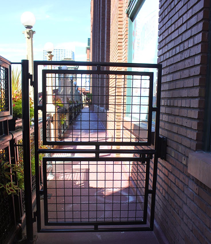
The passageway bridging State and Dearborn midblock between Lake and Randolph is called Couch Place.  In Old Chicago, it was a street, the southern boundary of the Tremont House, one of the city's early high-end hotels.  Long ago, however, it became nothing more than a narrow alley, a place where deliveries were made, garbage was kept to be picked up, and rats scurried across the pavement, unseen but heard.  The fine facades along Randolph Street may have been of gleaming terra cotta, but at the stage door end of the building, it was plain, homely alley brick, often with cheap paint flaking off of its surface.  The bright marquees out front spoke to our hopes and illusions, the claustrophobic, menacing alleys to our fears and darker realities.  It was kind of place you could imagine Elisha Cook, Jr. skulking in a doorframe, or Humphrey Bogart emerging rubbing his head after being hit from behind by someone who thought he was getting too close to the truth.

And then they went and cleaned it up. As a part of the attempt to revive Chicago's theater district, Couch Place was gussied up in 2007.  The dumpsters went away, new paving installed, and vintage posters mounted evoking the days when the alley held the stage doors to movie palaces such as the Oriental and State-Lake.  The tall neon sign for the new Goodman theater lined up as the alley's visual terminus to the west.
Even with all that, Couch Place remains very sparsely traveled.  Thursday night, however, it was wall-to-wall people, as it was premiere of FLOW/Im Fluss, a new light and water installation by Luftwerk, a/k/a artists Petra Bachmeier and Sean Gallero, creators of such striking temporary artworks as Luminous Field at Cloud Gate, and this past winter's Spring Light for the Chinese New Year, at the Chicago Cultural Center and McCormick skating rink at Millennium Park.  In October, the pair will mount INsite, lighting up Mies van der Rohe's iconic Farnsworth house.
Petra Bachmeier and Sean Gallero being photographed
by Public Art in Chicago's Jyoti Srivastava

Flow/Im Fluss celebrates the 20th anniversary of Chicago and Hamburg being named as Sister Cities.
Inspired by the element of water and its all-encompassing connectivity, Luftwerk�s FLOW/Im Fluss visualizes the characteristics of the Chicago River and Hamburg�s River Elbe through video compositions projected on water screens. 
Based on scientifically collected measurements like oxygen levels, currents, contamination, and chemical compounds FLOW/Im Fluss interprets data from the two rivers to create a visual experience. ?The projected video will illuminate screens made of water - inviting viewers to immerse themselves into the flow of data collected from both rivers. 

The event, which also includes music, is sponsored by the Goethe Institut and Chicago Loop Alliance, as part of its sequence of events Activating spaces in the Loop with temporary art installations.
The best way to experience Flow/Im Fluss is to walk through it, from State to Dearborn and back. Step into the lines and swirls of light piercing the darkness, and walk through the fine mist that both provides the screen for the projected geometric forms and imparts to you as a visitor an almost baptismal cleansing of the dirt and squalor of the �dark alley�  of the soul. 


Minggu, 14 September 2014

Flip City, Prelude: the End of St. Dominic's

click images for larger view
Flip City is a story about how a city and the architecture that defines it evolve over time.  The more I explore, the more epic it becomes, so I'm breaking it into multiple chapters to explore more aspects of the theme, and make the whole thing manageable, both for myself and for you as a reader.
For all but the youngest of us, the story of the neighborhood north of Chicago and east of Goose Island is one of the rise and fall and death of Cabrini-Green, the massive and increasingly troubled public housing complex that dominated the area for decades.
It's latest chapter is one of gentrification, personified in the massive New City shopping center now rising at Clybourn and Halsted.  Yet in, in fact, the story is far larger and much longer, one almost as old as Chicago itself, beginning with the first settlements on open land and how they became a dense ghetto, a close-knit community of first generation Chicago immigrants and the institutions that served them.

In other areas of the city, important remnants of that immigrant history remains.  The old buildings may have completely new uses, but they endure.  At Cabrini-Green, however, there are no surviving markets, no theaters, or settlement houses.  All that remains is a handful of old churches, and one of them, St. Dominics, is about to meet its end.
According to a story by architecture critic Lee Bey, the church was consecrated in 1905, designed by architect William J. Brinkmann at a cost of $60,000.  It was built to hold 1,000 worshippers, something it had little trouble doing in its early decades, when the area around it was a dense slum of Swedish, Irish and, predominantly, Italian laborers.  Is was so tough a neighborhood, it was actually referred to as Hell.
 
St. Dominic's Church, located at the corner of Locust and Sedgewick Streets, was founded by the Reverend E.M. Griffin in 1905.  The style of architect of this fine church is a pleasing combination of Roman and Gothic.  The parish being located in a large manufacturing district, the congregation is composed almost entirely of Italians.  The 400 children who attend the school are taught by the Sisters of Charity of the B.V.M . . .  Illustrated Souvenir of the Archdiocese of Chicago, 1916
Beginning in the 1942, the slums became the object of �urban renewal.�  The old buildings were demolished in favor of public housing.
At first it was the low-rise row houses of the original Frances Cabrini homes.  They still remain, behind chain link fencing, on borrowed time.  Then in the 1950's came the now infamous high-rises, over 10,000 people herded into a succession of towers that began in optimism and devolved into gang infestation, crime and endemic violence.

For the bureaucrats, it was far more difficult to pursue actual solutions than simply blame the architecture. The Chicago Housing Authority initiated a Plan for Transformation whose primary impetus was to make neighborhoods close to downtown safe for gentrification, cleansing the area of the poor, collecting subsidies from the feds for units kept vacant, and accumulating hundreds of millions of dollars in reserves, even as the waiting lists for public housing grew.
Today, huge swaths of empty land remain the primary legacy of the CHA's �transformation.�  Once seven to ten story CHA high-rises were right across the street from St. Dominic's.  Now there's only empty lots.  St. Dominic's was closed in 1990, and since then the building has been used to store items received from local or closed parishes.  The photograph below is from the bulletin of St. Joseph's Church, on Orleans near Division.  In it, Father Lawrence Lisowski writes . . .
When I stepped into the dusty and musty church, it felt like I wa stepping back into a sacred time and place, like walking into an ancient ruin in Rome.  .  . 
St. Dominic's has now been sold and the site rezoned.  The old church will be razed for a new seven-story, 40-unit condo building designed by Axios Architects for Conlon and Company, scheduled for completion in 2016.
Not everything can be saved, and truth be told, despite the craftsmanship of its brickwork,  St Dominic's is a rather heavy design.  I've previously argued against the demolition of churches that represented a continuity of community.  In the case of St. Dominic's, however, that continuity has long since been yanked out from under it; the community that once surrounded it smashed to bits, force-depopulated, and replaced by featureless lawns that deny it ever existed.

There's a new Target on Division where Cabrini Green once stood.  A new apartment tower is now rising right across the street.  If everything goes as planned, the new condo building where St. Dominic's now stands will form the foundations of a next chapter.  New development may well eventually fill in all those empty lots, but that new city will be an engineered tabula rasa, expunged of history.
This building is on Larrabee, just a few blocks from St. Dominic's, with half-million dollar condos and a $6,000 a month penthouse.  Anonymous and dispiriting, will this be the face of the new Hell?  Are buildings like this one and the one that will replace St. Dominic's our new tenements, housing not the working poor, but the upwardly mobile?  With our lives growing increasingly inward and virtual,  will the new landscape be devoid of the kind of architectural expressions of larger community that St. Dominic's represented?
 One idea of an alternative mediation will be the subject of our next post in this series.

Minggu, 07 September 2014

Along Chicago's New Skyscraper Row: One Rises, One Descends, and One Just Spreads it Around

click images for larger view
Saturday seemed a good day to check out the progress and three large construction projects that have made the bend of the Chicago River big development central.

See the complete photo-essay, after the break . . .

Wolf Point West
At the former service parking lot at Wolf Point, construction crews were hard a work (does everyone get time-and-a-half for Saturdays?). Cranes were in place, and rising from the ground was the concrete service core for Wolf Point West, the river-hugging, 493-foot high, 510 unit residential tower from bKL Architecture that's the first three projected skyscrapers for the site
The concrete structure that's the support a long driveway and entrance to what will eventually be a large below-grade garage looks already to be in place.

Wolf Point West will also include a tight stub of parkland to the east and west, while the far larger park that supposed to separate the three towers will continue to be the truncated remnant of the original surface parking lot until funding is in place for the other two towers.


River Point
On the opposite bank of the river, a bit to the south, the concrete structure that covers the Metra tracks and will provide the surface for the new 1.5 acre park that's being financing by $29 million in Chicago TIF funds.  Nonetheless, that park is not scheduled for another two years, upon the completion of the 52-story River Point office Tower at 444 West Lake Street, designed by Pickard Chilton and scheduled to open early in 2017
Right now, not only is there little visible above ground, but they're digging a deeper hole.  The week's torrential rains had left the site a soggy mess, but that didn't an industrious shovel operator from continuing to excavate soil.

150 North Riverside
Perhaps the most interesting goings-on were at the site for 150 North Riverside, a 1.2 million square-foot, 53 story, Goettsch Partners designed tower that's been competing for tenants with River Point, moving towards a scheduled 4th-quarter 2016 completion.  Last week, Crain's Chicago Business was reporting that developer John O'Donnell has just nailed down almost $300 million to complete financing for the half-billion dollar building, which he claims is already 28% leased.

Like River Point, 150 North is also to be set within a 1.5 acre park, also covering the Metra tracks, but the key difference is this time the city didn't get stuck with the bill - the developer is picking up the costs.  
photograph: Bob Johnson
A new river edge has been put into place to protect the site during construction, and while there's barges (I suspect that at the time of its commercial zenith many decades  ago, the entire Chicago River was of this kind of green sludgy consistency). . .


. . .  but the main activity on Saturday was a power shovel slowly spreading a carpet of rubble across the entire surface of the site.
 

So that's it for now.  It's like what Groucho said in Animal Crackers . . .
We took some pictures of the native girls, but they weren't developed.  But we're going back again in a couple of weeks

Read More:


Hour of the Wolf: The Transformation of the Pivot Point of Chicago

The Park at River Point Makes Train Tracks Disappear

 Giant Punch Stamp on the River? First Renderings for 150 North Riverside

 The Art of the Pitch: Selling 150 North Riverside to the Neighbors


Chicago's Public Riverwalk a-Building; Public/Private Riverwalk a-closing

click images for larger view
Going for a walk downtown along the Chicago River these days inevitably is dominated by the massive, ongoing construction site that's the new Riverwalk being constructed along the south bank.  Just last week, the passage that will allow pedestrians to walk beneath the Dearborn Street bridge was put into place.

Maybe it was just bad timing, however, but on Saturday the story along the northern and western banks - where the riverwalk consists of a sequence of private walkways open to the public - was a decidedly different story, as if the property owners league had decided to give a big middle finger to the Chicago public.
At the Reid Murdoch building, the passage from Clark to LaSalle remains closed.
. . .  as was the riverwalk next to Riverbend across fromWolf Point, but perhaps the management of 300 North LaSalle put it most succinctly . . .

Senin, 01 September 2014

Division Street Bridge gets Old Bailey Runaround

click images for larger view
It was only this past July when we wrote of the quick demolition of the 1903 Division Street bridge over the North Branch Channel at the eastern edge of Goose Island.  Within a few short weeks, nary a trace of the structure remained.
Map: Chicago Department of Transportation
Now it's temporary replacement is being put in place just north of where the old bridge stood, with completion scheduled for next month.  $6 million was budgeted both for the demolition and the temporary span.

The provisional structure is a Bailey Bridge, named after its inventor, Donald Bailey.  An employee of the British War Office during World War II, Bailey liked to create model bridges as hobby, but the design he created for a bridge constructed out of lightweight, precision-made modular steel components was anything but a toy.
The pieces could be transported on ordinary trucks, and assembled by hand into ten foot-long 5 foot-high cross-braced rectangles that weighed only 570 pounds and could be lifted into place by six, probably burly men.  No heavy-duty construction equipment was required, yet the bridges were strong enough to carry a convoy of tanks.  The Bailey Bridge became the western allies' standard military bridge.  Over 2,000 were constructed, with 700,000 Bailey panels providing 350 miles of bridging.  Field Marshall Montgomery credited the Baily Bridges with helping speed the path to victory by creating the ability to quickly construct crossings that sustained an aggressive forward movement of troops and supplies.  Bailey Bridges remain in use today throughout the world, with the longest spanning 2,585 feet, and the highest rising over 18,000 feet above sea level.
Nothing quite so spectacular is at play at Division Street.  The standard roadway width of a Bailey Bridge is 12 feet, and the temporary bridge at Division Street will consist of two twelve-foot vehicular lanes, and another pair of roadbeds split between a 6-foot-wide bike lane and 5-foot wide sidewalk.  Skipping over three spans, the interim bridge will be 261 feet long, and will remain in place until the anticipated completion of the permanent replacement directly in line with Division Street in December of 2017. New concrete moorings have already been put in place on the western embankment . . .
. . . soon to support Bailey's tinkertoys as they begin to creep across the English North Branch Channel.
With commercial traffic on the river a tiny sliver of what it was when it functioned as a major industrial thruway, the new bridges at Division Street are part of a continuing city initiative to replace Chicago's historic bascule bridges, whose spans can be raised to accommodate tall vessels, with fixed span tied-arch bridges.  The 1909 Halsted Street bascule bridge, less than a block south of Division, was already replaced with one of the fixed span prototypes in 2011.
The new Division Street bridge looks remarkably similar, but in red rather than blue.
Rendering: Chicago Department of Transportation

Read More:
photograph: Bob Johnson

Short Division